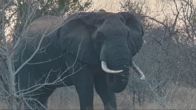
In Zinave National Park, the search is on for the ideal elephant to collar – one which will go on to provide vital information to the management team about its movements and behaviour within the park.
Zinave’s Savannah aircraft radios in a sighting of an elephant herd. Helicopter pilot Delport Bothma and wildlife vet Hugo Perreira respond, taking to the skies to pick up the visual. For pursuing and darting wildlife, the agility of a chopper, and the space for its passengers to maneuver themselves and their equipment, far outperforms that of a fixed wing aircraft.
As Delport traces the location provided, they spot the breeding herd moving through one of the park’s trademark dense forests. Here, a clear line of sight is impossible, so they gently steer the elephants through the trees and out into an open area. Zinave boasts a beautiful mosaic of diverse habitats, from woodland and bush to pans, wetlands, and savanna. Being able to move the herd to a space with less vegetation is key for the job they’re here to do.
The Craft of Collaring
Flying lower, the collaring candidate can be picked out: a specific elephant cow. She is about to become an informant for the park’s management team, as she reveals her deepest elephant secrets! With expert aim, Hugo shoots a dart which contains a carefully calculated dose of sedative to immobilise her safely. In a critically coordinated and rapid response,the ground crews move in swiftly to complete the procedure, making sure the elelphant’s airway is open.
Approaching any wild animal must be done with extreme care – even if under sedation, since each individual can respond differently to being tranquilised. The team needs to ensure that she is in a deep sleep and monitored attentively, for their own safety and the wellbeing of the elephant. The satellite collar, equipped with advanced tracking technology, is securely fastened around the elephant’s neck; the antidote is then administered to reverse the effects of the sedative, and within minutes this magnificent giant is back on her feet.
A Crucial Tool for Conservation Planning
This high-tech accessory is a vital component of the team’s toolkit to effectively address the challenges of #ConservationAtScale. Zinave National Park occupies more than 4000 km² of the almost 100,000 km² Great Limpopo transboundary landscape, which embraces Mozambique, South Africa and Zimbabwe. Mozambique’s @National Administration for Conservation Areas and Peace Parks are on a collaborative journey to restore, manage and develop this vast ecosystem. Throughout the expanse of habitats, the pressure on resources, threat of poaching and interactions between people and wildlife demand a strategic approach.
Being able to track species closely using satellite collars, linked to mobile devices and advanced software, provides a deep insight to inform crucial decision-making in real-time. It also gathers historical data on patterns of behaviour, from which predictions about future movements can be made. This creates a detailed map of their location and usage of different areas, including when they break fences, and where water resources should be focused to best cater for their needs. Being able to plan appropriate responses and approaches can bring a new level of accuracy to conservation measures.
Let’s celebrate the wonders of conservation technology and skill of Zinave’s teams in helping to better protect complete, complex ecosystems and ensure a flourishing future for this flagship protected area.